Llantwit Major Walk
We start in St Illtud’s Church, which dates back to the 12th century, and described by John Wesley as the ‘most beautiful church in Wales’. The restored Galilee Chapel at the western end of the church has some fine 9th and 10th century Celtic Christian stones.
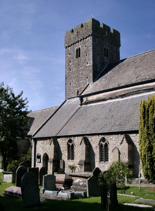
The ‘East Church’ retains medieval wall-paintings and the unique Jesse Niche.
St Illtud founded his monastic school at Llantwit Major in about 490, ‘Britain’s earliest centre of learning’. We don’t know the exact site of his ‘llan’ or Christian community, but it was probably in the flat valley bottom of Cwm Colhuw, described as ’a most fertile open plain’ and called vallis prospera, ‘prosperous valley’. Here children were taught ‘rhetoric, grammar and arithmetic’ and adults trained as missionaries. The community included families as well as single men and women.
The main thoroughfares were the sea routes, and there is evidence of a port at Llantwit Major, to and from which the Celtic saints would make their journeys to Cornwall, Brittany and Ireland.
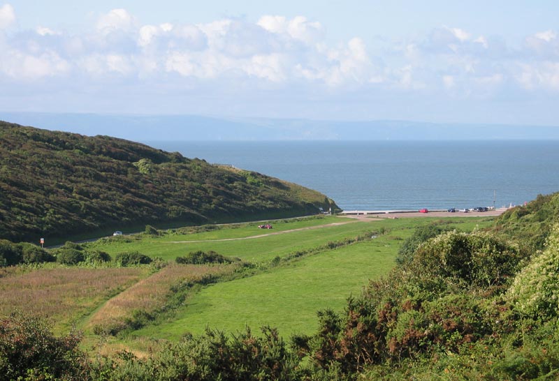
From the beach we climb the steps up to the cliff path, going as far as Tresilian Bay. We can imagine the Celtic Christians walking these paths 1500 years ago, looking out to sea and wondering where they may be called to travel.
We return to St Illtud’s Church along ancient field tracks and lanes, used by farmers, travellers—and pilgrims—for many centuries.
The Celtic Christian community probably moved from their site near the sea to where the present church is built in the 8th-9th century as the result of raids by Irish pirates and Vikings. This became a royal burial ground, as shown by the crosses now in the Galilee Chapel.
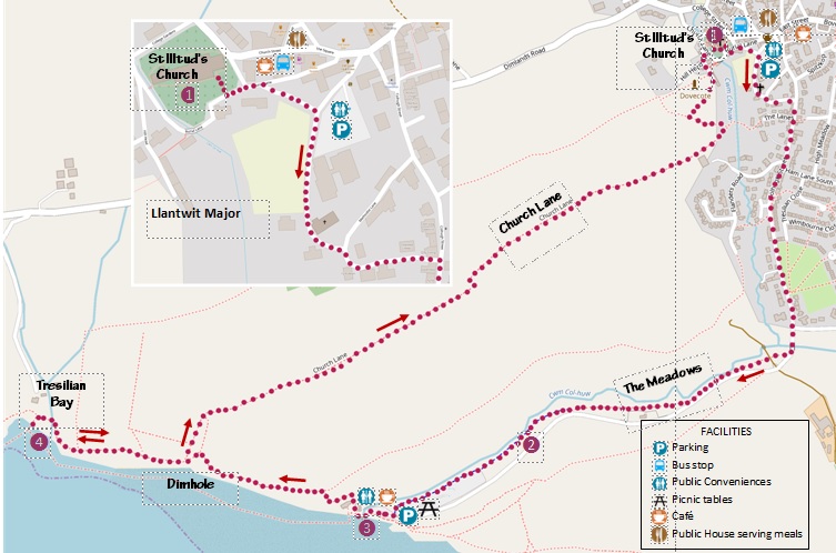
Start St Illtud’s Church, Llantwit Major CF61 1SG (SS 9660 6872)
Getting there 303 bus from Bridgend or 304 from Barry; trains from Bridgend and Cardiff. Car Parks in the town.
Walk
From the south gate of St Illtud’s Church (1) turn left following the boundary wall to the top, then at the junction of lanes turn right, with the Town Hall carpark boundary wall on your left and a field on your right (see insert). Follow the lane to its junction with Colhuw Street.
Turn right down the hill, staying on Colhuw Street, which becomes Beach Road, until you reach a mini-roundabout at the end of the houses. Continue down the hill, over a small bridge, to a metal kissing-gate on your right.
Walk through the Meadows to the sea, keeping the river on your right.(2)
The 12th century Life of St Illtud describes how he came to this wide flat valley, with steep cliffs on either side, running down to the beach. The ground was fertile; the river provided ample water. So Illtud built himself a hut, and for the next three months learnt how to pray. He fed on wild roots and fruit, but also cleared the land round his hut and sowed seed.
This valley near the sea became the largest school in the whole of Britain. Kings and chiefs sent their children here; many other monks came to share in God’s mission led by Illtud. A number, such as Samson, Gildas and Paulinus, crossed to Cornwall and Brittany, and established Christian communities there.
On the site of this first monastery, reflect on your commitment to God and his mission to bring the good news of salvation-wholeness-to all people.
On reaching the mouth of Afon Colhuw at the popular Llantwit beach (3) you have the opportunity to use the facilities—toilets, café, and picnic area.
According to legend, it was Illtud’s monks who built the ridge of pebbles across the beach to prevent the monastery being flooded. There is no visible evidence—only written—of the former port, though it must be remembered that the land extended much further out into the Bristol Channel at the time; coastal erosion is very obvious through the many cliff falls along this stretch.
Take the path between the café and the Surf Rescue building and climb up to the cliff top, where there is a metal bench for walkers to ‘rest and be thankful’.
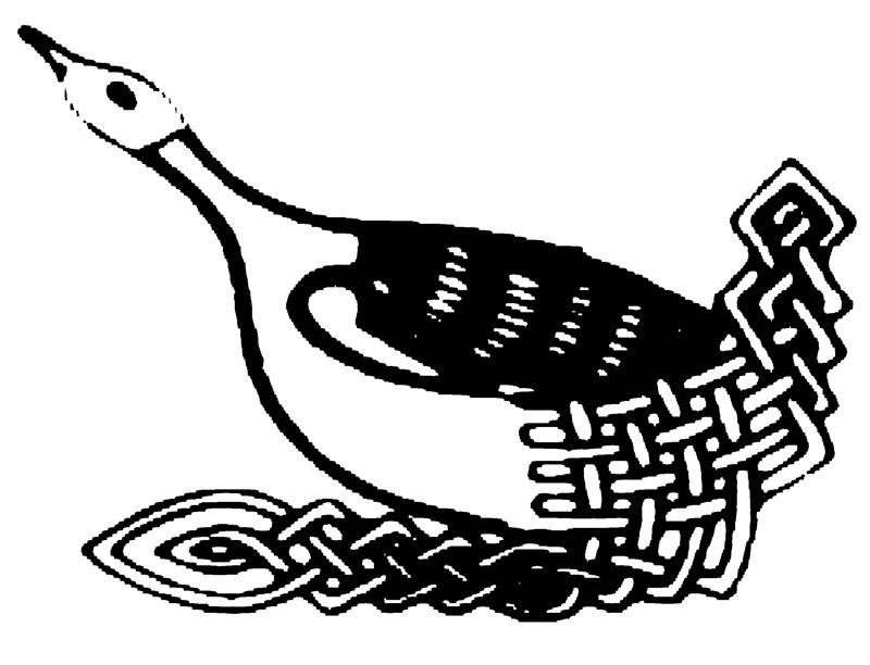
As seafarers, the Celts had a great respect for the sea, marvelling at its constant movement, the rise and fall of the tide, which here is the second greatest in the world. They saw themselves as caught up in the ebb and flow of the whole of creation, and could see that each one of us is a very small and frail craft in a mighty ocean. So there are many Celtic Christian prayers for protection, and particularly for the guidance of the Holy Spirit, for which the Celtic Christian symbol is the Wild Goose. As you stand or sit on the cliff top above the beach, pray with the saints of old “Wild Goose, come to me.”
Continue along the surfaced path on the cliff top, taking in the views across to Exmoor. You will come to another bench, before the path drops down to Dimhole. Take the path up the other side, and again follow the cliff path.
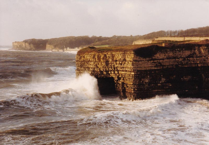
You will pass a World War 2 pill-box and then come to another bench over-looking Tresilian Bay (4), named after the court (tre) of the 4th century Prince Silian. The cave, known as Reynard’s or Cathedral Cave, was a favourite site for clandestine marriages.
The cave may have been used by the monks of Illtud’s monastery as a place for quiet contemplation. Use this spot to reflect on the beauty and glory of God’s creation, looking at the waves that have been driven over thousands of miles of open water across the Atlantic by the south-westerly winds and have beaten into the cliff face, over the years weakening it and dislodging tonnes of material. The constant movement—the world is in a state of constant movement, all is flowing, all is changing—God creating, continually creating.
If you wish, you may descend to the bay, and if the tide is out, explore the cave. Otherwise, turn back along the cliff path to Dimhole, and instead of going up the other side, take the path inland. You will come to a stile. There take the path to the right, following the edge of a field. Another stile and gate takes you into Church Lane, between two hedges. Follow this for half a mile, before it turns sharp left.
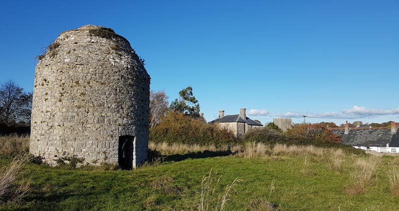
Instead of continuing on Church Lane, go over the stile in front of you and cross over the Dovecot field. The Dovecot and the Gate House on Church Lane are the surviving remains of the Grange farmed by the monastic community of Llantwit Major of the 12th to 16th centuries.
At the top of the field is a white stone stile set in the wall; climb over the stile, turn left and follow the road down to St Illtud’s Church to conclude the walk.
Map
OS Explorer 151 Cardiff and Bridgend
Public Transport
The 303 NAT bus runs hourly in both directions between Bridgend and Llantwit Major, connecting with the 304 to Barry. Trains from Cardiff and Bridgend. For up-to-date travel information visit www.traveline-cymru
Refreshments
Llantwit Major has a wealth of cafés providing drinks and meals, restaurants and pubs.
The beach café is open all the year round.
Information
Guide books and leaflets in St Illtud’s Church; information boards in the town and at the beach.