Wick, Monknash & Marcross
The three parishes of Wick, Monknash and Marcross were linked together in 1950, and then became part of the Llantwit Major Benefice in 1983, eventually joining the new Glamorgan Heritage Coast parish.
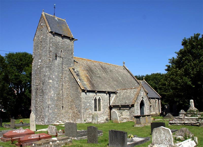
The chancel arch, the chancel window and the font of St James’ Church, Wick, remain from the original Norman building; the rest is 13th century, though heavily restored in the 19th century.
St James is the patron saint of pilgrims, symbolised by the scallop shell.
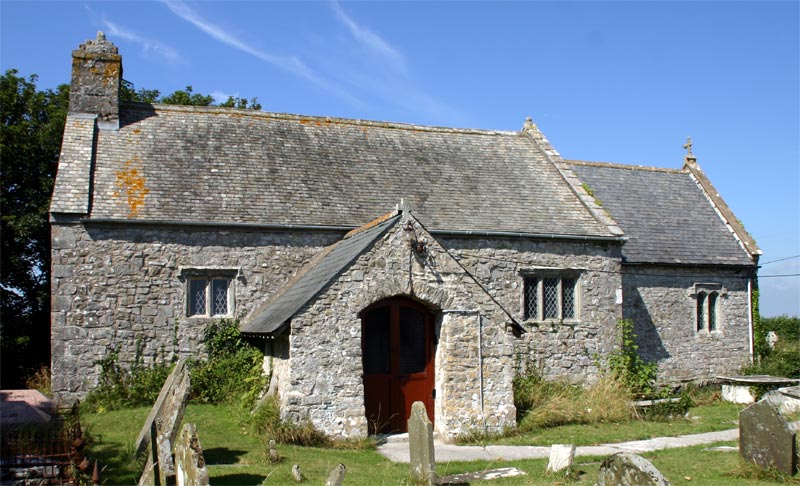
St Mary’s Church, Monknash, was originally a chapel of Neath Abbey, with nearby the monastic grange which supplied food for the Abbey. The small church has been heavily restored but its medieval origins can still be seen.
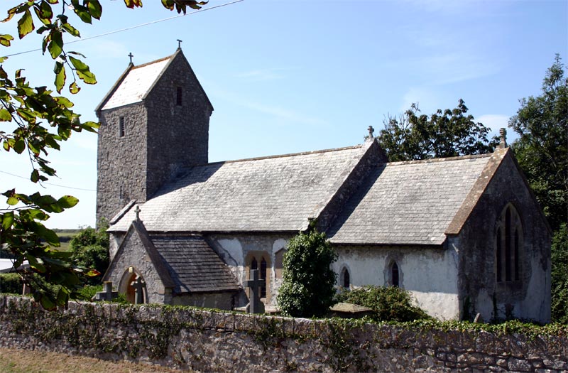
Holy Trinity Church, Marcross, retains many of its Norman features but with later 13th and 14th century additions.
Our walk takes us down to the coast to follow the Wales Coast Path and the distinctive features of Cwm Nash and Nash Point, but turning inland for Monknash and Marcross churches.
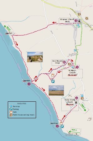
Start
St James’ Church, Church Street, Wick CF71 7QE (SS 9234 7217)
Getting there B4265 from Bridgend or Llantwit Major. On-street parking by church. 303 bus from Bridgend or Llantwit Major to Church Street.
Walk
From the Church (1), follow Church Street towards the Village Green, continuing along the edge of the Green into Trepit Road. Continue along Trepit Road for 0.5 miles to a T-junction. At the junction turn left, and immediately cross the road to a stone stile next to a gate, marked ‘Cwm Bach 1½ miles’. Walk along an overgrown track to a stile leading into a field. Cross this and two more fields to reach the head of Cwm Bach (2). Follow the path downhill, on the left hand side of the stream, towards the sea. Towards the lowest point, take the steep path up the left hand side to the cliff top.
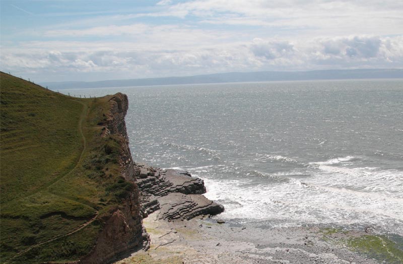
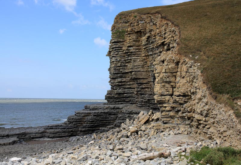
On reaching the cliff top and the Wales Coast Path, turn left, following the path in a south-easterly direction for 1.2 miles. There are a number of stone stiles to negotiate along the way. The path then steeply descends to Cwm Nash (3).
Go onto the beach (depending on the tide) and look up at the low tufa bank just to the west of the valley. In recent years, bones have been visible at a height of about 23 feet from ground level, and the site has been excavated a few times by archaeologists. The conclusion is that this cliff-top was the burial ground for the local residents before the churchyard of Monknash Church was used for this purpose from 1607 onwards—but also for shipwrecked mariners as a large number of late medieval shipwrecks have been recorded on this stretch of coast. The skeletal remains discovered date from the second half of the 16th century.
We remember all those ‘who go down to the sea in ships’, those who bring us food and goods. “Oh, hear us when we cry to Thee, For those in peril on the sea.”

From the beach turn inland following the stream on your left. You enter Cwm Nash, the path first bounded by blackthorn and gorse, then entering a beech tree wood. This is the Blaen-y-Cwm Nature Reserve. Just up the valley on the left hand side is a holy well, Ffynnon Fair, and at the head, the remains of a medieval mill. The stream flows from the Mill in a series of cascades.
the Mill in a series of cascades.
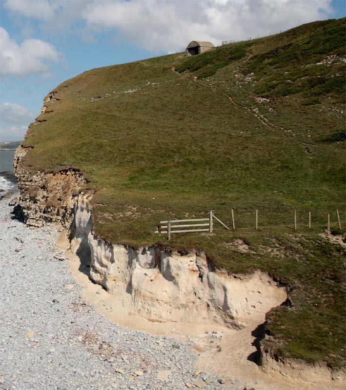
When you reach a road, cross it to a stile and continue through the field, keeping the stream to your left. Cross the footbridge, bear right and follow the path over a number of stone stiles, keeping the stream on your right. You will reach the site of a Monastic Grange (4) of the Cistercian Neath Abbey, which owned and farmed much of the land around. Turn right across the stream, and then left, over a stile into the grounds of the Grange. The Grange was established in 1130 and continued until 1533; now only the banks and ditches can still be seen.
Walk through the Grange over stone stiles with the stream on your left until you reach the final stile by a shed leading onto Heol Las. Turn right to walk along the road for 0.3 miles, passing the turn to the Plough and Harrow, to reach St Mary’s Church, Monknash (5).
Here give thanks for the monks of Neath who built this church in Norman times and for the generations of worshippers who have kept it open. Pray for the farming community of this area on whom we depend for food.
Retrace your steps along Heol Las. Shortly on the right is a stone stile with a path leading back to Wick; if you don’t want to go on to Marcross, follow the green route on the map. Otherwise, turn left at the sign for the Plough and Harrow, and continue down the lane for a mile, passing the Heritage Coast Campsite with its café, back to Cwm Nash and the cliff top. Climb up the left hand side of the cliff and at the top follow the Wales Coast Path for 1½miles until you reach the steep descent through the ramparts of an iron age promontory fort at Nash Point (6).
Crossing the stream by a footbridge, climb up the path on the other side of the valley to the cliff top and road. Here you may wish to visit the lighthouses; otherwise continue inland along the road for ½ mile to Holy Trinity Church (7), the end of our pilgrimage of the Three Churches.
At the church, pray for the mission and ministry of the Glamorgan Heritage Coast parish—and reflect on this walk, and what you have seen and heard on the way, giving thanks for the blessings of this pilgrimage.
If returning to Wick by bus, walk up the road through the village for ¼ mile to the T-junction at the Horseshoe pub. Turn left for the bus stop just past the pub.
Map
OS Explorer 151 Cardiff and Bridgend
Public Transport
The 303 NAT bus runs hourly in both directions between Bridgend and Llantwit Major through Wick, Monknash and Marcross, connecting with the 304 to Barry, and trains to Cardiff. For up-to-date travel information visit www.traveline-cymru
Refreshments
The Star and the Lamb and Flag pubs in Wick;
The Plough and Harrow pub in Monknash and the Horseshoe in Marcross;
Café at the Heritage Coast Campsite, Monknash and at Nash Point Car Park.